
Park Map - - - Gerard Hiking Trail Map
The Gerard Hiking Trail is 100% volunteer maintained by the Over the Hill Gang.
This 36-mile loop trail is located within Oil Creek State Park and the Drake Well Museum property. It is a large loop trail that runs down the East and West sides of the Oil Creek Valley. There are four connecting trails that enable hikers to plan varying length hikes. The historic site of Drake Well is at the northern end and Rynd Farm is at the southern end.
Oil Creek State Park consists of over 7,000 acres of wooded hills, deep hollows and over 12 miles of meandering Oil Creek in the scenic and historic Oil Creek gorge. Most of the oil boom locations have returned to the natural beauty of the wild, and look almost as they did before Drake drilled for oil in 1859.
The trail passes through or near most of the famous sites of early oil history, such as Miller Farm, Shaffer Farm, Boughton, Pioneer and Petroleum Centre. The trail will take the hiker past small waterfalls and scenic overlooks.
The main trail is marked with yellow blaze painted on trees. Connecting trails are marked with white blaze. A double blaze marks a sharp change in direction.
Drake Well Museum and Petroleum Centre (Egbert Farm) have picnic facilities, visitor centers, parking and restrooms. Blood Farm Day Use Area also has picnic facilities and restrooms.
Parking is allowed only at designated parking areas.
15 Best Trails in OCSP -- at -- AllTrails.com
YouTube video of a hike on the Gerard Trail
YouTube video of the Wolfkiel Run section of the Gerard Hiking Trail

The trail was named after Ray Gerard, park volunteer, who developed and maintained the trail for 16 years.
Mr. Gerard began construction of the trail about 1981 by connecting
deer trails, oil lease and timber roads together to form a trail
along the outer edge of the park boundry.
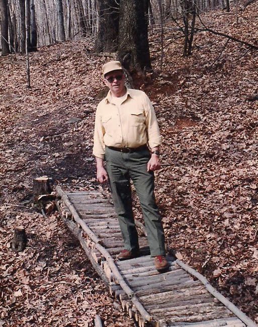
Mr Gerard built bridges over small streams using locally available materials like rocks, fallen trees and branches. The photo shows Ray Gerard standing on one of the many bridges he created.
Mr. Gerard passed away in January of 1997.
He organized the volunteer group, The Over-The-Hill Gang". that is responsible for most maintenance of the trail today.
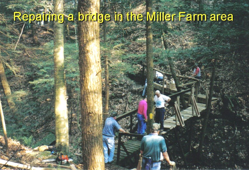
The Over the Hill Gang meets every Wednesday year round, weather permitting, to do trail work. The group breaks into 3-4 person teams and fan out to work on different sections of the trail. Their main focus is to clear the trails of fallen trees and debris that has accumulated over time. Each team covers a 4 - 8 mile section of trail. it is an ongoing challenge to keep all areas cleared. In addition to removing downed trees the group keeps the yellow and white blaze trail markings visible for hikers.
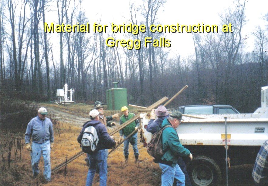
They maintain and replace foot bridges that traverse wet areas and small ravines. Where the trails run horizontally to the hillside, small fallen trees are placed and secured to the downhill side of the trail to prevent erosion from damaging the trail. They also cut back vegetation from the trail edges. The group also splits fire wood for the park's Adirondack Shelter fire places. Clearing scenic overlook areas and maintaining benches is also an important function of the Gang.
Thanks to the volunteers who have amassed thousands of volunteer hours in maintenance of the trail.

Adirondack-type shelters are open year-round for overnight backpackers. Trail shelter areas are located at Wolfkiel Run on the west side of the valley and Cow Run on the east. Each area has six shelters (each shelter accommodates 3 to 4 people). There is also a tent area, restrooms and firewood (kindling is not provided). Water is supplied on a seasonal basis - please check when you register. Fires are allowed only in the central fire ring and shelter fireplaces.
Fees are charged by DCNR and not the Friends of Oil Creek State Park. Shelters are designed to allow longer hiking trips, not for extended camping experiences. Dogs must be on a leash at all times and under the control of the hiker.
Some winter views of camping at the Adirondack shelters a YouTube video
Another YouTube video of the Adirondack shelter in winter
Idelwild Family visit to Oil Creek State Park
Organized Group Camping is also available at the Ski Hut and the Wildcat Hollow areas